British Columbia Maps Home > British Columbia Map Collection > Vancouver City Map
Printable Map of Vancouver City
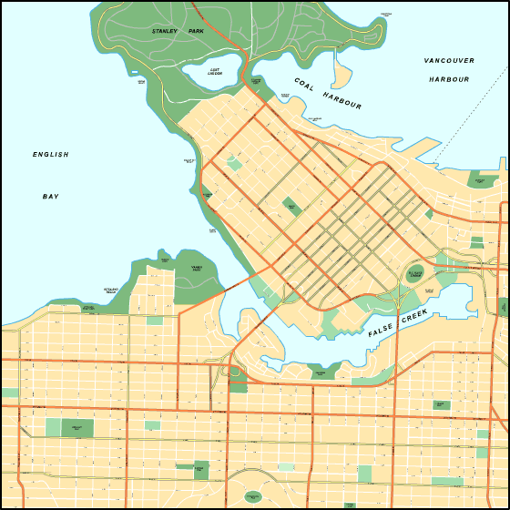
The map above is a basic map that shows the geography of this territory with a simple collection of map components.
Of course, you may share this file and use it for a variety of purposes. Providing a link to here would be considerate and well thought of.
In the case that you desire assistance retrieving a map, a particular map, or desire a high quality customized production, you can contact us.
Purchase good customized maps from us. A tailor-made product produced by us encompass a wonderful selection of details, for example: nodes of transportation, scale bar, GPS coordinates, bays, major municipal/district areas, low vegetation, geographical areas, or recreational sites, etc. Types of maps vary from economic geography to orthophoto, folded to rolled, block groups to urban areas.
High Quality maps are correct, complete, and not deceptive. Fine cartography by YellowMaps.
To buy physical maps, e.g. wall maps, country maps, or hiking maps, just pay a visit to our map shop It contains thousands and thousands products.
We like to help you. If you have any questions, please do ask! We are very friendly :D
Back to British Columbia map collection